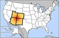
You know the famous national landmark, Four Corners?
 It's the exact location where Colorado, New Mexico, Arizona, and Utah come together.
Every year thousands of tourists visit the marker designating where the four states meet, and they take pictures of themselves straddling four states.
Like this girl:
Cute, but a waste of time. Because the marker is off:
Four Corners — the only place in the United States where four state boundaries come together — was first surveyed by the U.S. government in 1868, during the initial survey of Colorado's southern boundary line. Its intended location was an even 109 degrees west longitude and 37 degrees north latitude.
However, due to surveying errors, it didn't come out that way.
According to readings by the National Geodetic Survey, today's official marker sits at 109 02 42.62019 W longitude and 36 59 56.31532 N latitude.
That means the current monument marking the intersection of Utah, Colorado, New Mexico and Arizona is approximately 2.5 miles west of where it should be.
According to three different Internet sites for distance calculations (including an FCC site and GPS visualizer) the readings were 2.493; 2.484; and 2.499 miles.
So that ruins that vacation memory.


